We stopped in Elko for a meal, noting that the Beach Boys were arriving the next day - quite a ways from the beach I would say! We then headed into the mountains, where a pre-reserved campsite awaited us. The campground was nearly deserted, so in this case the reservation forced us to stay near a family that was settled in with lanterns and radio instead of seeking a more remote spot (should have spoken to the host about moving I suppose). The weather was fine, bugs were nowhere in sight, and at over 8000 feet we were ready to deprive ourselves of oxygen in preparation for the hike. We were constrained by vacation-time to staying out only three days, which would leave plenty to see another time - but we were ready for whatever we could get!
 Near the Dollar Lakes we were already crossing
white patches, though the trail was quickly found on the other side, but at
Lamoille Lake the path became substantially buried. Footprints suggested the
way, but we soon found the trail again and with a few more snow crossings we
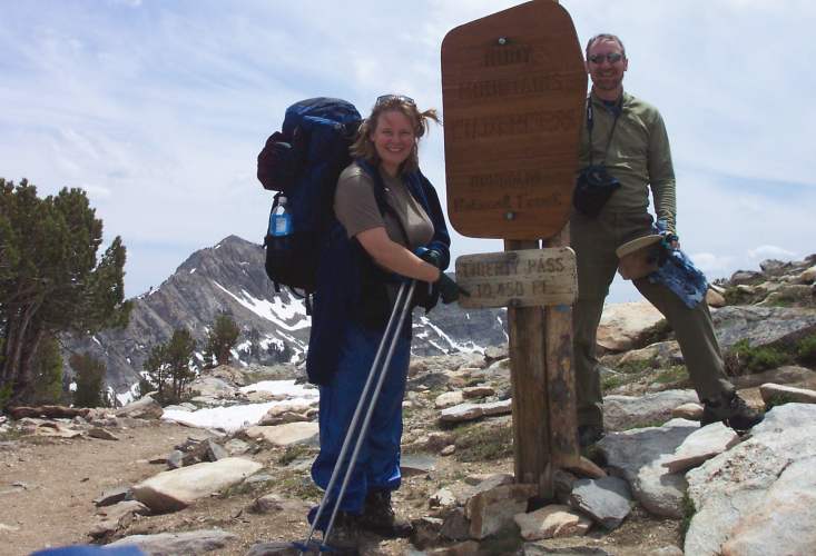
soon had Liberty Pass in our sights. A dayhiker passed us here, bringing total
human presence to three so far. We soon crested the 10450-foot pass and savored
the fine views.
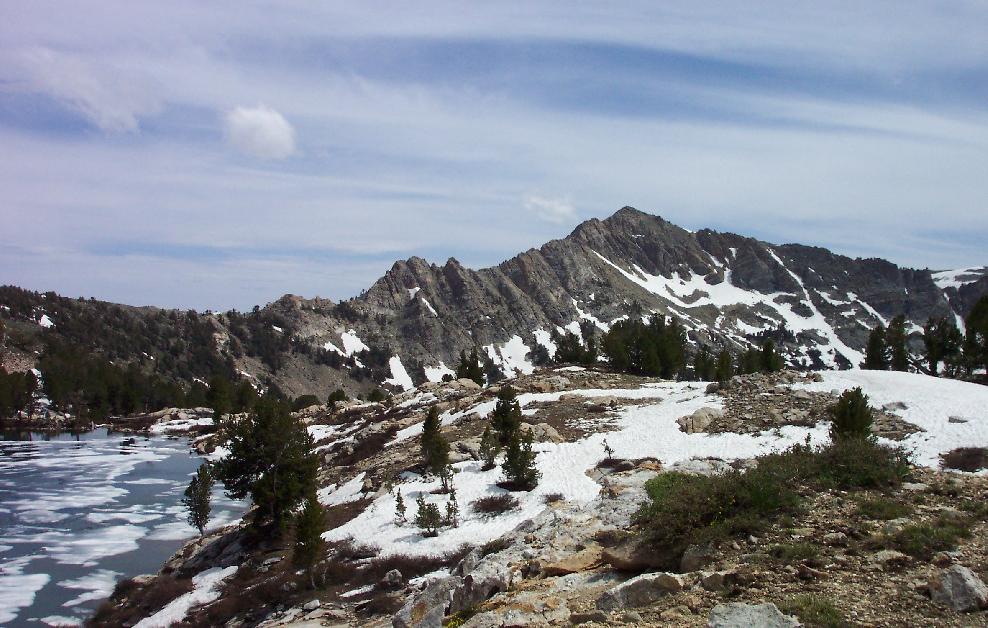
It turned out that views to the south would improve below the pass, and we soon
had a wonderful panorama from above snowbound Liberty Lake, with Lake Peak
(10920') and Castle Lake revealed in the distance.
 Behind Lake Peak was the
summit of Wines Peak; at that point the Ruby Crest National Scenic Trail (that's
the official name of our path) reached 10850 feet and did its level best to stay
there for miles. We had hoped to camp at Furlong Lake below that peak, but the
snowfields were wearing us down more swiftly than we had planned. We took a
long break near Liberty Lake's shore, then re-evaluated our camp as we sought
the path beyond another large snowfield (footprints were becoming scarce here,
beyond dayhikers' limits!). We finally regained the path, with Favre Lake now
revealed in the valley between Liberty and Castle Lakes. It looked pleasant
enough, and by camping there we could still dayhike to the summit of Wines Peak
and look to our south before returning to camp. We set up at a nice spot,
filled a bucket with water for cleanup and meals, and relaxed a while.
By dinnertime a chill west wind was rising, rather spoiling the relaxation we
had looked forward to. Soon all clothes were on our backs, and even the hot
meal could only provide so much warmth. By 7PM we gave up and retreated to the
tent, even adding the rainfly despite the harmless-looking clouds just for its
windbreaking properties. That night was a long one, and not terribly restful
for Kerry; it was a relief when the sun finally rose and freed us from the small
shelter we had retreated to twelve hours before.
We returned to camp, ate dinner at noon, then packed everything up for the
return trip. We were in decent shape, with only minor altitude effects, but the
full packs slowed us back to day-one speed. We'd also be hitting snowy slopes
going downhill, which is a much different proposition from climbing and brings
the risk of slipping and post-holing into play. We soon reached Liberty Pass
again, and noted that many directions were now obscured by rain - or, more
likely, snow!  The next half-hour was pretty straightforward, but the large
snowfields above Lamoille Lake now awaited us. Our reward at the lake was a
stock-path to the trailhead, which was on the north side of the canyon wall and
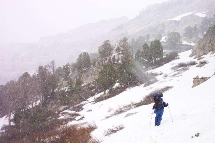
had much less snow than our day-one route. We both slid and post-holed more
than once before reaching the lake, and as we did so the snow began. Summer had
begun 48 hours before, and I was in Nevada; nevertheless, it was indeed
snowing.
More bad news awaited us here. While the stock trail beckoned a short distance
away, it was guarded by deep snow that ended at the end of a large and cold
creek - the outlet from Lamoille Lake was swift and dangerously cold. After
trying to find a place where we could cross further down, it became clear that
no safe way could be found to cross the snowbank and stream - so we reluctantly
turned back to the footpath. Thunder now growled over the ridgeline to our
southeast, meaning that this was my first-ever experience with Thundersnow! We
passed the Dollar Lakes again, and soon found the light snow and thunder
replaced with quieter but much snowier conditions. We crossed several more
snowfields while this was going on, then finally reached more consistently solid
ground. The snow relented for a while, but as we neared the 8800-foot trailhead
it came back in pellet form. Soon we were back at the car, with a wild day
mostly behind us. We had seen as much of the Rubies as time and weather had
allowed, and I expect that both of us will return to finish the route some day!
Quite a bit of daylight remained to us, so we wandered back to Elko in search of hot springs, or maybe a hot-tub motel? We ate a decent meal prepared on something other than a campstove, then headed west again. With few towns to select from (and no Tranquility Motel - read Dean Koontz' "Strangers" to understand that reference!), we reached Battle Mountain early in the evening. Kerry sprung for a room there (two queen beds gave us a LOT more space than that little tent!) and after soaking a while it was bedtime.
At the very least, I would take new routes to get to familiar places - so I went north along CA89 and the west side of Tahoe. Everybody was riding bikes in this area (was I drooling again?), but soon I was in more remote areas past the lake. I finally turned from 89 at the entrance to Lassen Park, which meant that on separate trips I had now been on the length of that highway from Shasta to Monitor Pass - whoopee? I reached Red Bluff in time for dinner and bedtime, with a short swim for good measure.
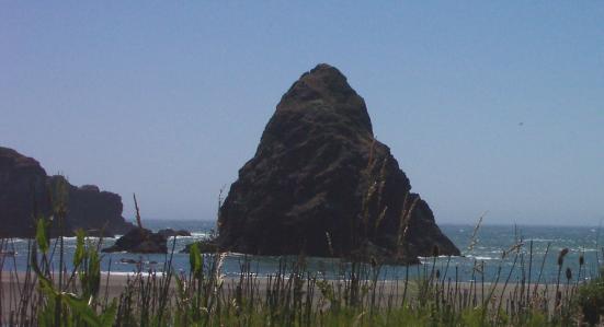
 Soon I was feeling much better, stopping at one of my favorite beaches anywhere,
Whaleshead in Boardman State Park. After a bit of wading and beachcombing I
continued northward. From Coos Bay north I could see the coastal fog just
onshore, much more familiar to me than this 80-degree stuff. I drove along a
particularly sinuous stretch of road as the sun sank into the writhing
cloudbank, which was itself moving south at around 20 miles per hour; the effect
was otherworldly (made even more so with the Tangerine Dream soundtrack on my
stereo!). The clouds had settled in to stay after Bandon, but I stopped there
for a big meal and a quick tour of the Bandon Dunes golf course. What a
gorgeous golf layout, I'd better start practicing soon and get down there again.
I finally ran out of steam at Yachats, and treated myself to an ocean-view room
and a bottle of beer.